What Grows in District of Columbia

USDA Zones 7b-8a · 39-43 inches annual rainfall

District of Columbia spans USDA hardiness zones 7b-8a, with a growing season of about 190 frost-free days — a true four-season rhythm: spring greens, a full summer main crop, and a fall window that rewards planning.

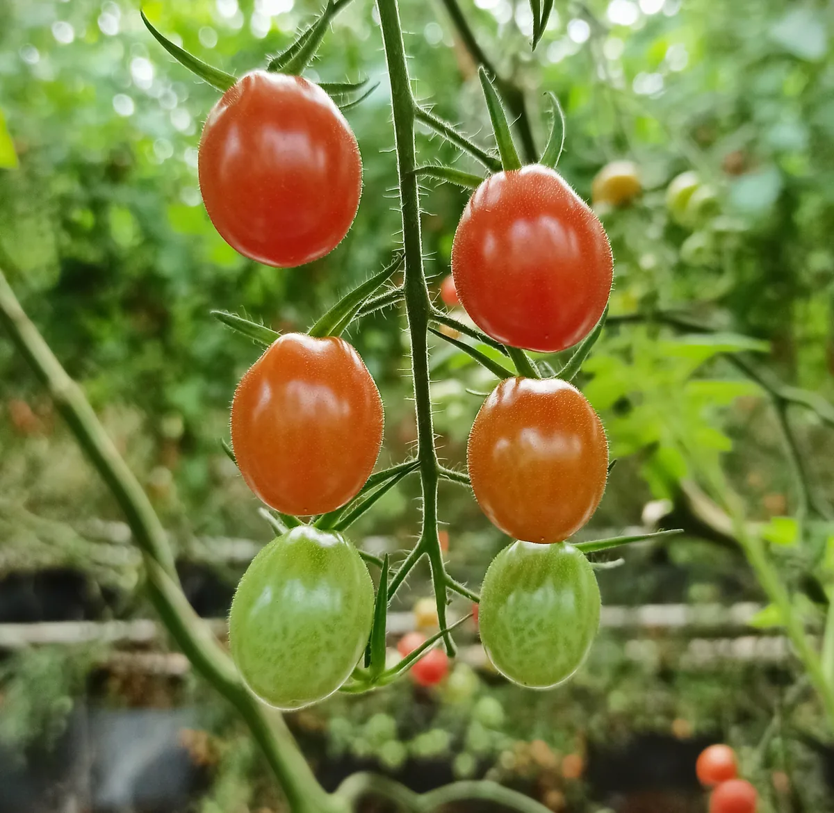
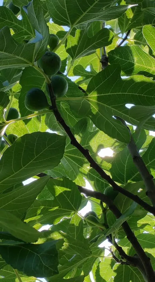
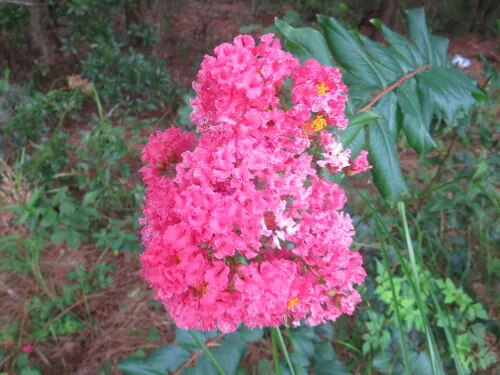
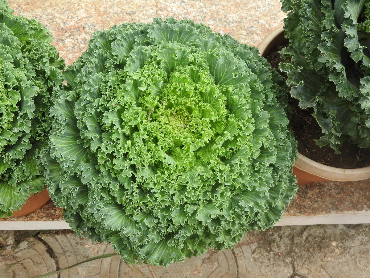
Behind the zone label sits the real climate engine: 39-43 inches of annual rainfall, a median of roughly 3,500 growing-degree days (base 50°F), and about 1,200 winter chill hours for tree fruit. The dominant soils run to urban fill, silt loam, clay loam, and sandy loam (Coastal Plain), and their drainage is one of the strongest predictors of which crops take hold and which falter. Reliable performers under these conditions include tomato, fig, crape myrtle, and kale; what your own ground favors still comes down to its soil, sun, and drainage.

Grounded inUSDA PHZM 2023NOAA Climate NormalsUSDA NRCS SSURGOGDD aggregate (Cornell CALS)Chill-hour aggregate (MSU Extension)EPA FRSUSDA PLANTSGrowable Ground suitability scoring

Score your parcel · free

Your yard isn't the whole state.

District of Columbia spans zones 7b-8a, but your yard sits in exactly one — and slope, tree cover, and low spots nudge it further. Enter your address and we'll score 1,112 plants against your land's actual soil, sun, and frost.

We read public map data for this spot — soil, climate, flood, and parcel records. How we handle your address.

No card required · your full report in seconds

Quick Facts

USDA Zones

7b-8a

USDA PHZM 2023

Last Frost

Apr 1 - Apr 20

NOAA 30-yr Normals

First Frost

Oct 25 - Nov 15

NOAA 30-yr Normals

Annual Rainfall

39-43 inches

NOAA Climate Normals

Zone maps are averages across District of Columbia. Your yard's slope, trees, and frost pockets shift what actually grows — see your land's exact reading.

The Ground You’re Working With

The soil types that dominate District of Columbia — how each drains decides more about crop success than almost anything else. Tap any soil to learn what it is and how to work with it.

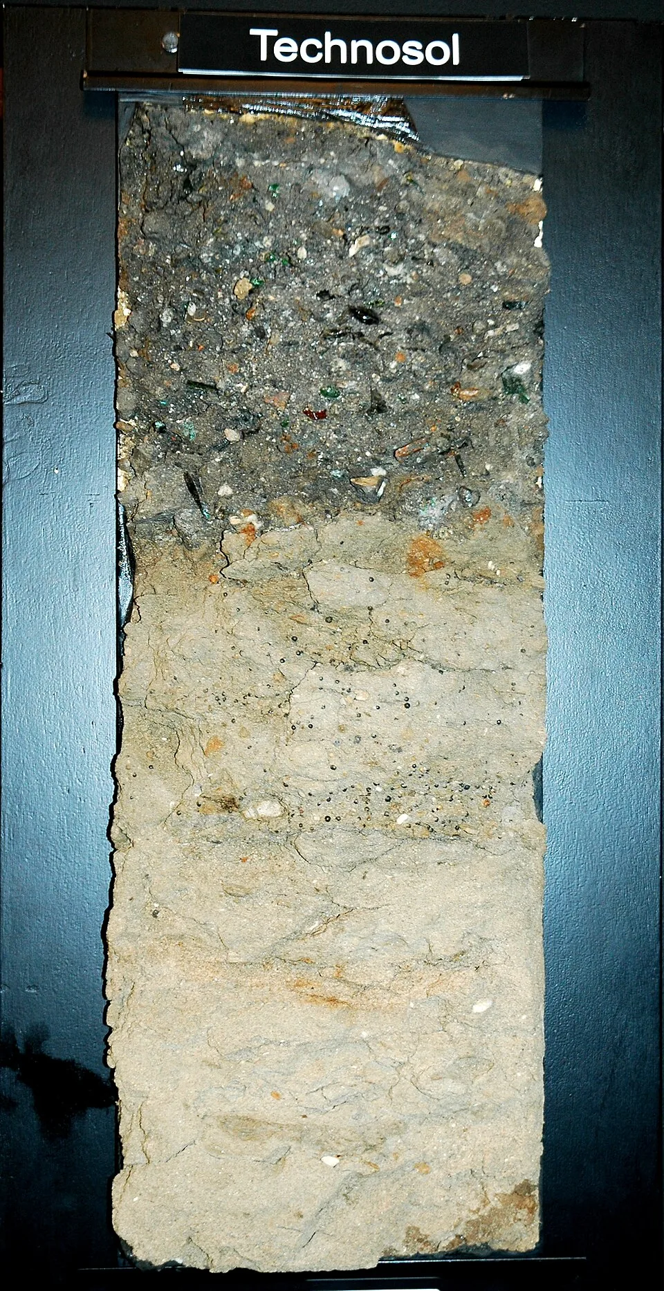
Technosol soil monolith showing buried glass, brick, and concrete debris in made ground
Technosol monolith: made ground with buried debrisPhoto: Rockwurm / ISRIC World Soil Information, CC BY-SA 3.0

Urban fill

  • Drainage

    Unpredictable — buried rubble can drain like gravel while compacted fill sheds water like pavement, sometimes within the same yard.

  • What thrives

    Plenty, once you know what you are working over: street trees, tough perennials, and productive raised-bed vegetable gardens are the backbone of urban growing.

How to work with Urban fill
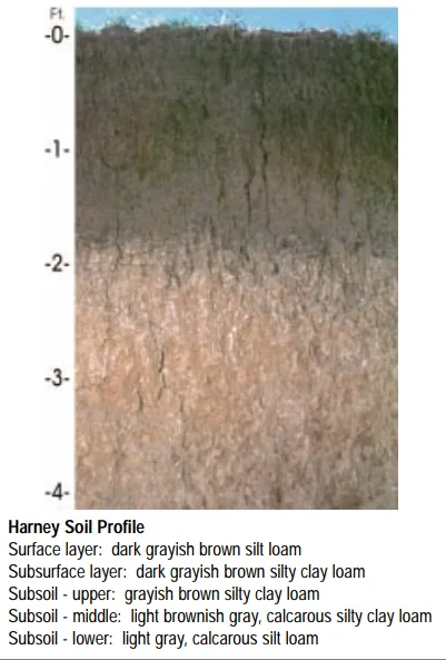
Harney soil profile: deep loessal silt loam with a dark grayish-brown surface
Soil profile: Harney series, Kansas

Silt loam

  • Drainage

    Moderate. Silt holds water well and releases it steadily, though the fine particles can crust after hard rain and compact under traffic.

  • What thrives

    The full vegetable garden does well here, and small grains, corn, and leafy greens are classic silt-loam crops. Its steady moisture suits shallow-rooted plants that dislike drought stress.

How to work with Silt loam

No verified open-license photo yet — this loam is close kin to the loam and silt-loam profiles above.

Clay loam

  • Drainage

    Slow to moderate. Water lingers in the root zone longer than in loam, which is a gift in dry summers and a challenge in wet springs.

  • What thrives

    Heavy feeders that appreciate steady moisture — brassicas, corn, beans, and many fruit trees. Perennials with strong root systems establish well once they are through the first season.

How to work with Clay loam
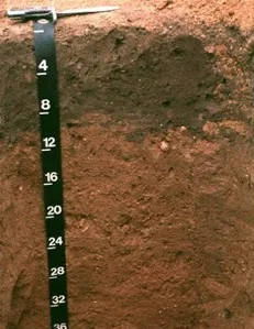
Downer soil profile: reddish sandy loam horizon with a depth scale
Soil profile: Downer series, New Jersey

Sandy loam (Coastal Plain)

  • Drainage

    Fast. The sand fraction opens the soil up, so water moves through the root zone quickly and the surface rarely stays soggy. The trade is that nutrients ride out with the water.

  • What thrives

    Root crops love it — carrots, potatoes, radishes, and onions size up cleanly in ground they can push through. Melons, sweet potatoes, asparagus, and most herbs appreciate the warmth and the drainage.

How to work with Sandy loam (Coastal Plain)

Soil data: USDA NRCS SSURGO · Soil types explained

State Symbols of District of Columbia

The plants District of Columbia put its name on — cultural emblems, not growing recommendations.

Official state flower

American Beauty rose

Rosa

Designated 1925.

Official state tree

Scarlet oak

Quercus coccinea

Designated 1960.

Official state fruit

Cherry

Designated 2006.

Native Plants of District of Columbia

Plants the USDA PLANTS Database documents as native and present in District of Columbia — a real per-state range, not just a zone match. Presence is statewide, so a plant may still be uncommon in your specific county; your state’s Cooperative Extension or a native-plant society is the local authority.

Also zone-compatible

US-native plants whose hardiness range overlaps District of Columbia’s USDA zones 7b-8a but which USDA PLANTS doesn’t map to a single state range here. Zone overlap is a starting filter, not a range map.

Browse all US-native plants by state & zone →

Growing Challenges in District of Columbia

What an experienced grower plans around here — each one has a move.

Dense urban siting means small lots, compacted fill soils, and limited sun

Containers and grow bags turn patios and rooftops into productive ground — and imported mix sidesteps fill-soil questions entirely.

Summer heat and humidity promote fungal diseases

Space for airflow, water mornings at the base, and lean on resistant varieties — the extension's humid-summer playbook.

The urban heat-island effect pushes summer temperatures above surrounding suburbs

The city's extra warmth is usable — it stretches the season for heat-lovers; check your true effective zone and plant to it.

For cultivar selection, pest pressure, and planting-time guidance specific to District of Columbia, the UDC Center for Urban Agriculture is the authoritative local source.

Safe to Grow Here?

What the federal record shows across District of Columbia — and how to grow with it.

Federal record: High

We checked the federal record across District of Columbia2,435 documented sites across 6 of the 9 source types we track.

The most significant on record: 50 Superfund sites. Sites tracked in EPA's Superfund program — from assessment-stage CERCLIS entries to confirmed National Priorities List cleanup sites.

District of Columbia carries one of the heavier federal records we track — and that's not a verdict on your yard. Proximity to a documented site is information, not a diagnosis: nothing here says any particular parcel is affected. It does earn one concrete step — before food beds go in the ground, a professional soil test tells you exactly what you're working with, and raised beds with clean imported soil grow well almost anywhere in the meantime.

Severity Distribution

across District of Columbia

High52Moderate375Low2,008

Highest-Severity Sites

Aaron'S Cleaners
Superfund · Superfund (Non-NPL)
Appalachia Rising Site
Superfund · Superfund (Non-NPL)
Baptized Believers Church
Superfund · Superfund (Non-NPL)
Barney Circle - Fed Fac
Superfund · Superfund (Non-NPL)
Bolling Air Force Base
Superfund · Superfund (Non-NPL)

A note from Gnorman

What an experienced grower watches for around here

In and around District of Columbia, Superfund runs higher than the national average — 50 sites nearby. It's not cause for alarm — it's worth knowing, and there's a sensible way to grow around it.

Superfund: Superfund sites represent the most severe contamination in the federal system.

Commission professional soil testing before any food production (test for heavy metals, VOCs, and SVOCs).

Sources: EPA, USGS1.8M documented sites tracked nationwide across 9 federal source types.

See what grows on YOUR specific land

State averages sketch the shape. Your soil, sun exposure, drainage, and microclimate decide what actually takes. Pull a site-specific report for your exact parcel.

Free Report

Read your District of Columbia parcel

Enter your address. We read your soil, sun, drainage, and frost dates, then score 1,112 plants against the real conditions on your land.

Three things about your exact spot that zone averages miss:

Your soil pHYour frost-free daysYour sun & shade

We read public map data for this spot — soil, climate, flood, and parcel records. How we handle your address.

25+ data sources analyzed in seconds

Frequently Asked Questions

What USDA hardiness zones are in District of Columbia?

District of Columbia spans USDA hardiness zones 7b-8a, per the USDA Plant Hardiness Zone Map 2023. Zones reflect average annual extreme minimum temperatures from 1991–2020 weather data.

When does frost risk typically end in District of Columbia?

The last spring frost in District of Columbia is typically around Apr 1 - Apr 20, and the first fall frost around Oct 25 - Nov 15, per NOAA 30-year climate normals (1991–2020). Your specific site may differ — frost dates vary by elevation, proximity to water, and local microclimate.

What vegetables grow well in District of Columbia?

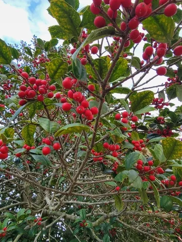
District of Columbia's zones 7b-8a support a wide range — strong performers include Tomato, Fig, Crape Myrtle, Kale, and American Holly. What actually takes on any one site comes down to its soil, sun, and drainage, and we score each plant against the real conditions at your address.

Which hardiness zone is District of Columbia, really?

Officially, District of Columbia spans USDA zones 7b-8a (USDA PHZM 2023) — but a zone is a 30-year average of winter's coldest night across an area, and it can't see any one yard. A south-facing slope, a tree line, or a low frost pocket can shift a single site by half a zone either way, which is why neighboring gardeners often quote different numbers. We read the conditions at your exact address — soil, sun, slope, and frost — and score 1,112 plants against what's actually there.

Is the soil safe to grow vegetables in District of Columbia?

The federal record across District of Columbia runs heavier than most — 2,435 documented sites — so test the soil before planting food in the ground, and raised beds with clean imported soil grow well in the meantime. Even here, proximity to a documented site is information, not a diagnosis of any one yard; the contamination map shows exactly what's recorded and where.

Just moved to District of Columbia — what should I know before planting?

Start with three facts. District of Columbia spans USDA zones 7b-8a, which sets what survives winter; the statewide frost window runs about Apr 1 - Apr 20 to Oct 25 - Nov 15 (NOAA 30-year climate normals); and 2,435 documented sites sit on the federal record here, so a soil test before food beds is the smart first step. From there, matching plants to your actual soil and sun is the fun part.


Everything on this page is a District of Columbia average. Your yard writes its own version — we read soil, sun, drainage, and frost at your exact address. Try it for 14 days — no card required.

Counties in District of Columbia

Explore growing conditions by county — each has its own zone range and land area.

Cities & Towns in District of Columbia

Explore growing conditions by city or town in District of Columbia.