What Grows in West Virginia

USDA Zones 5a-6b · 38-56 inches annual rainfall

West Virginia spans USDA hardiness zones 5a-6b, with a growing season of about 190 frost-free days — a season that fits spring and fall plantings of cool-weather crops around a solid warm-season core.

Every planting decision here sits downstream of 38-56 inches of annual rainfall, a median of roughly 3,500 growing-degree days (base 50°F), and about 1,200 winter chill hours for tree fruit. The prevailing soils — shale-derived, sandy loam, clay loam, and alluvial — differ most in how they drain, which is exactly where crop success is usually decided. On paper, apple, ramp, pawpaw, and sugar maple all suit these conditions — on the ground, soil, sun, and drainage make the final call.

Grounded inUSDA PHZM 2023NOAA Climate NormalsUSDA NRCS SSURGOGDD aggregate (Cornell CALS)Chill-hour aggregate (MSU Extension)EPA FRSUSDA PLANTSGrowable Ground suitability scoring

Score your parcel · free

Your yard isn't the whole state.

West Virginia spans zones 5a-6b, but your yard sits in exactly one — and slope, tree cover, and low spots nudge it further. Enter your address and we'll score 1,112 plants against your land's actual soil, sun, and frost.

We read public map data for this spot — soil, climate, flood, and parcel records. How we handle your address.

No card required · your full report in seconds

Quick Facts

USDA Zones

5a-6b

USDA PHZM 2023

Last Frost

Apr 15 - May 15

NOAA 30-yr Normals

First Frost

Sep 25 - Oct 20

NOAA 30-yr Normals

Annual Rainfall

38-56 inches

NOAA Climate Normals

Zone maps are averages across West Virginia. Your yard's slope, trees, and frost pockets shift what actually grows — see your land's exact reading.

The Ground You’re Working With

The soil types that dominate West Virginia — how each drains decides more about crop success than almost anything else. Tap any soil to learn what it is and how to work with it.

No verified open-license photo yet — clayey, plate-littered ground; see the limestone profile for the rock-born register.

Shale-derived

  • Drainage

    Two-natured: the clay fraction holds water while the shale fragments and fractured bedrock open channels, so hillside shale soils often drain better than their texture suggests.

  • What thrives

    Orchards and vineyards have long favored shale hillsides — the drainage and the heat the rock holds suit deep roots. Brambles, asparagus, and hardy perennials establish well.

How to work with Shale-derived
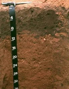
Downer soil profile: reddish sandy loam horizon with a depth scale
Soil profile: Downer series, New Jersey

Sandy loam

  • Drainage

    Fast. The sand fraction opens the soil up, so water moves through the root zone quickly and the surface rarely stays soggy. The trade is that nutrients ride out with the water.

  • What thrives

    Root crops love it — carrots, potatoes, radishes, and onions size up cleanly in ground they can push through. Melons, sweet potatoes, asparagus, and most herbs appreciate the warmth and the drainage.

How to work with Sandy loam

No verified open-license photo yet — this loam is close kin to the loam and silt-loam profiles above.

Clay loam

  • Drainage

    Slow to moderate. Water lingers in the root zone longer than in loam, which is a gift in dry summers and a challenge in wet springs.

  • What thrives

    Heavy feeders that appreciate steady moisture — brassicas, corn, beans, and many fruit trees. Perennials with strong root systems establish well once they are through the first season.

How to work with Clay loam
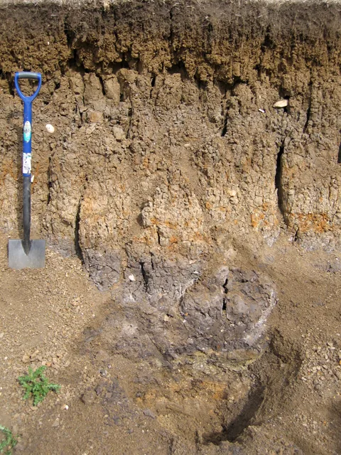
Layered river-laid alluvium in a floodplain soil pit, with a spade for scale
River-alluvium profile (Fladbury series), Great Ouse floodplainPhoto: Rodney Burton, Geograph, CC BY-SA 2.0

Alluvial

  • Drainage

    Usually good: rivers sort their loads, and most alluvial soils have enough sand and silt to move water while holding plenty for roots. Low-lying pockets can run wet.

  • What thrives

    Nearly everything — vegetables, orchards, vines, and berries all prosper on alluvium. Its depth lets roots go as far down as they care to.

How to work with Alluvial

Soil data: USDA NRCS SSURGO · Soil types explained

Top 5 Plants for West Virginia

Plants well-suited to West Virginia's climate, soils, and growing season — each links to its full growing profile.

Is it too late to plant in West Virginia?

Rarely: the season closes in stages, not all at once, and each stage has its crops. Across West Virginia, cool-season planting typically opens about four weeks before the local last hard freeze — county medians put that freeze near Mar 20, with the middle half of counties between Mar 15 and Mar 22 (NOAA 1991–2020 climate normals). Tender transplants wait two to three weeks past it, and fall planting counts back from first freezes mostly between Nov 17 and Nov 23 — long-season crops need about 90 days of runway, quick greens only 30. A long window like this one runs successions deep into fall — and even its last weeks take quick greens and garlic.

State Symbols of West Virginia

The plants West Virginia put its name on — cultural emblems, not growing recommendations.

Official state flower

Rhododendron

Rhododendron maximum

Designated 1903.

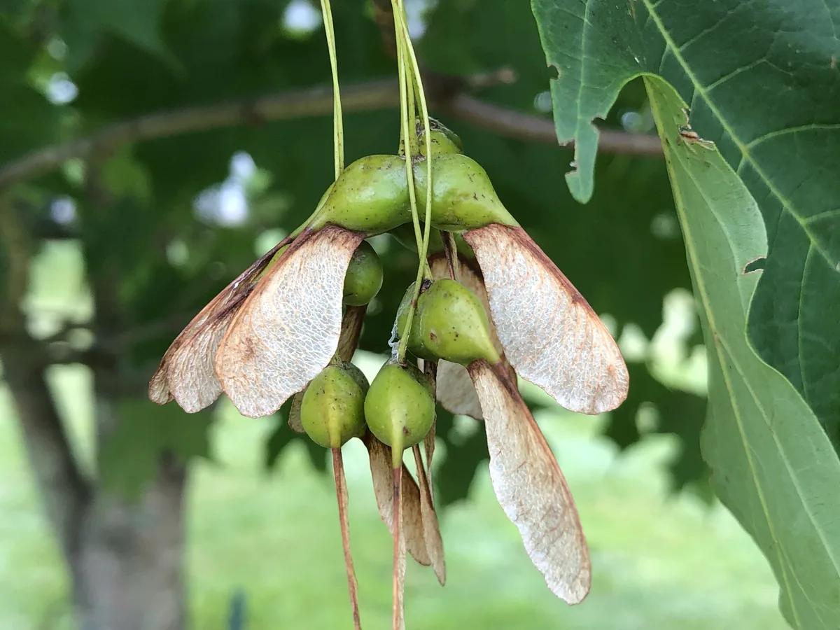
Sugar maple, photograph
Official state tree

Sugar maple

Acer saccharum

Designated 1949. In our plant library — see its full growing profile.

Official state fruit

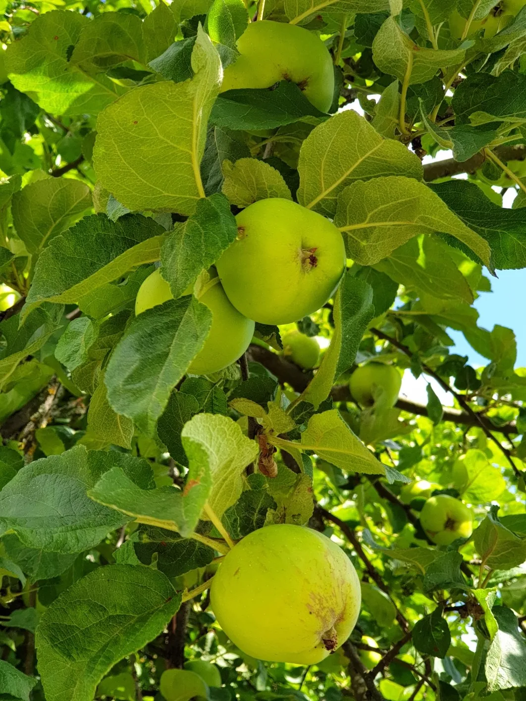
Golden Delicious apple

Designated 1995.

Native Plants of West Virginia

Plants the USDA PLANTS Database documents as native and present in West Virginia — a real per-state range, not just a zone match. Presence is statewide, so a plant may still be uncommon in your specific county; your state’s Cooperative Extension or a native-plant society is the local authority.

Also zone-compatible

US-native plants whose hardiness range overlaps West Virginia’s USDA zones 5a-6b but which USDA PLANTS doesn’t map to a single state range here. Zone overlap is a starting filter, not a range map.

Browse all US-native plants by state & zone →

Growing Challenges in West Virginia

What an experienced grower plans around here — each one has a move.

Steep terrain limits usable growing area

Grow with the hill, not against it — terraced beds turn slopes into some of the best-drained ground there is, and your extension office has terracing guidance for exactly this country.

Thin acidic soils over shale bedrock

A soil test shows exactly how thin and how acid — then lime, compost, and built-up beds put depth where shale left none.

Short mountain valley growing seasons

Valley frost pockets shorten the season — fast varieties and a cold frame give the weeks back.

For cultivar selection, pest pressure, and planting-time guidance specific to West Virginia, the WVU Extension is the authoritative local source.

Safe to Grow Here?

What the federal record shows across West Virginia — and how to grow with it.

Federal record: High

We checked the federal record across West Virginia17,312 documented sites across 7 of the 9 source types we track.

The most significant on record: 112 Superfund sites. Sites tracked in EPA's Superfund program — from assessment-stage CERCLIS entries to confirmed National Priorities List cleanup sites.

West Virginia carries one of the heavier federal records we track — and that's not a verdict on your yard. Proximity to a documented site is information, not a diagnosis: nothing here says any particular parcel is affected. It does earn one concrete step — before food beds go in the ground, a professional soil test tells you exactly what you're working with, and raised beds with clean imported soil grow well almost anywhere in the meantime.

Severity Distribution

across West Virginia

High154Moderate5,644Low11,514

Highest-Severity Sites

13TH Street Lab and Rad Site
Superfund · Superfund (Non-NPL)
Adrian P S D
PFAS Sampling · PFAS Detected
Alderson Broaddus University
Superfund · Superfund (Non-NPL)
Allegany Ballistics Laboratory (Usnavy)
Superfund · Superfund NPL
American Cyanamid
Superfund · Superfund (Non-NPL)

Know Before You Grow

  • Underground tanks can leak petroleum products. Soil testing near former gas stations is recommended.
  • Raised beds with imported soil can reduce exposure risk near brownfield sites.
  • Test well water for nitrates if you rely on a private well. Levels above 10 mg/L require treatment.

Sources: EPA, USGS1.8M documented sites tracked nationwide across 9 federal source types.

See what grows on YOUR specific land

State averages sketch the shape. Your soil, sun exposure, drainage, and microclimate decide what actually takes. Pull a site-specific report for your exact parcel.

Free Report

Read your West Virginia parcel

Enter your address. We read your soil, sun, drainage, and frost dates, then score 1,112 plants against the real conditions on your land.

Three things about your exact spot that zone averages miss:

Your soil pHYour frost-free daysYour sun & shade

We read public map data for this spot — soil, climate, flood, and parcel records. How we handle your address.

25+ data sources analyzed in seconds

Frequently Asked Questions

What USDA hardiness zones are in West Virginia?

West Virginia spans USDA hardiness zones 5a-6b, per the USDA Plant Hardiness Zone Map 2023. Zones reflect average annual extreme minimum temperatures from 1991–2020 weather data.

Is it too late to plant in West Virginia?

Rarely: the season closes in stages, not all at once, and each stage has its crops. Across West Virginia, cool-season planting typically opens about four weeks before the local last hard freeze — county medians put that freeze near Mar 20, with the middle half of counties between Mar 15 and Mar 22 (NOAA 1991–2020 climate normals). Tender transplants wait two to three weeks past it, and fall planting counts back from first freezes mostly between Nov 17 and Nov 23 — long-season crops need about 90 days of runway, quick greens only 30. A long window like this one runs successions deep into fall — and even its last weeks take quick greens and garlic.

When does frost risk typically end in West Virginia?

Across West Virginia, the middle half of counties see their last hard freeze (28°F) between about Mar 15 and Mar 22, with a county median near Mar 20 (NOAA 1991–2020 climate normals). That marks the hard freeze, not the last light frost — light frosts can still bite for a few more weeks, so tender transplants usually wait another 2–3 weeks.

How long is the growing season in West Virginia?

Measured between 28°F hard freezes, growing seasons across West Virginia's counties mostly run about 242 to 252 days, with a county median near 245 (NOAA 1991–2020 climate normals). Tender crops get a somewhat shorter practical window, since lighter frosts reach a few weeks past the hard-freeze dates on both ends.

What vegetables grow well in West Virginia?

West Virginia's zones 5a-6b support a wide range — strong performers include Apple, Ramp, Pawpaw, Sugar Maple, and Ginseng. What actually takes on any one site comes down to its soil, sun, and drainage, and we score each plant against the real conditions at your address.

Which hardiness zone is West Virginia, really?

Officially, West Virginia spans USDA zones 5a-6b (USDA PHZM 2023) — but a zone is a 30-year average of winter's coldest night across an area, and it can't see any one yard. A south-facing slope, a tree line, or a low frost pocket can shift a single site by half a zone either way, which is why neighboring gardeners often quote different numbers. We read the conditions at your exact address — soil, sun, slope, and frost — and score 1,112 plants against what's actually there.

Is the soil safe to grow vegetables in West Virginia?

The federal record across West Virginia runs heavier than most — 17,312 documented sites — so test the soil before planting food in the ground, and raised beds with clean imported soil grow well in the meantime. Even here, proximity to a documented site is information, not a diagnosis of any one yard; the contamination map shows exactly what's recorded and where.

Just moved to West Virginia — what should I know before planting?

Start with three facts. West Virginia spans USDA zones 5a-6b, which sets what survives winter; last hard freezes range from about Mar 15 to Mar 22 across its counties (NOAA 1991–2020 climate normals); and 17,312 documented sites sit on the federal record here, so a soil test before food beds is the smart first step. From there, matching plants to your actual soil and sun is the fun part.

Everything on this page is a West Virginia average. Your yard writes its own version — we read soil, sun, drainage, and frost at your exact address. Try it for 14 days — no card required.

Cities & Towns in West Virginia

Explore growing conditions by city or town in West Virginia.

AccovilleAddison (Webster Springs)AdrianAlbrightAldersonAlum CreekAmherstdaleAnawaltAnmooreAnstedApple GroveArbovaleArthurdaleAthensAuburnAuroraBancroftBarboursvilleBarrackvilleBartleyBartowBath (Berkeley Springs)BaxterBayardBeards ForkBeaverBeckleyBeech BottomBelingtonBelleBelmontBelvaBenwoodBergooBerwindBethanyBethlehemBeverlyBig ChimneyBig CreekBig SandyBirch RiverBlacksvilleBlennerhassettBluefieldBluewellBoazBolivarBoltBoomerBoothBowdenBradleyBradshawBramwellBrandonvilleBrandywineBrentonBridgeportBrookhavenBrunoBrush ForkBuckhannonBudBuffaloBurlingtonBurnsvilleCairoCamden-on-GauleyCameronCapon BridgeCarolinaCarpendaleCassCassvilleCedar GroveCenturyCeredoChapmanvilleCharles TownCharlestonCharlton HeightsChattaroyChaunceyCheat LakeChelyanChesapeakeChesterClarksburgClayClearviewClendeninCliftonCoal CityCoal ForkColcordColliersComfortCorinneCottagevilleCovelCowenCrab OrchardCraigsvilleCrooked CreekCross LanesCrumCrumplerCucumberCullodenCunardDaileyDanielsDanvilleDavisDavyDeep WaterDelbartonDespardDixieDorothyDunbarDupont CityDurbinEarlingEast BankEast DaileyEast ViewEcclesEleanorElizabethElk GardenElkinsElkviewEllenboroEnterpriseEskdaleFairleaFairmontFairviewFalling SpringFalling WatersFalls ViewFarmingtonFayettevilleFenwickFlatwoodsFlemingtonFollansbeeFort AshbyFort GayFrankFranklinFriendlyGallipolis FerryGallowayGartenGaryGassawayGatewoodGauley BridgeGhentGilbertGilbert CreekGlasgowGlen DaleGlen FerrisGlen ForkGlen JeanGlen WhiteGlenvilleGraftonGrant TownGrantsvilleGranvilleGreat CacaponGreen BankGreen SpringGreenviewGreenvilleGypsyHambletonHamlinHandleyHarmanHarpers FerryHarrisvilleHartford CityHartsHedgesvilleHelenHelvetiaHendersonHendricksHenlawsonHepzibahHicoHillsboroHilltopHinklevilleHintonHoldenHollygroveHometownHooverson HeightsHundredHuntersvilleHuntingtonHurricaneHuttonsvilleIaegerIdamayInstituteInwoodItmannJacksonburgJane LewJeffersonJuniorJusticeJustice AdditionKanawhaKenovaKermitKeyserKeystoneKimballKimberlyKincaidKingwoodKistlerKopperstonLashmeetLavaletteLeonLesageLesterLewisburgLittletonLoganLost CreekLubeckLumberportMabscottMacArthurMadisonMaldenMalloryManManningtonMarlintonMarmetMartinsburgMasonMasontownMatewanMathenyMatoakaMaybeuryMcConnellMcMechenMeadow BridgeMiddlebourneMiddlewayMill CreekMiltonMineralwellsMitchell HeightsMonavilleMonongahMontcalmMontgomeryMontroseMoorefieldMorgantownMoundsvilleMount CarbonMount Gay-ShamrockMount HopeMullensNeibertNettieNew CumberlandNew HavenNew MartinsvilleNew RichmondNewarkNewburgNewellNitroNorth HillsNorthforkNortonNutter FortOak HillOakvaleOceanaOmarOsagePaden CityPagePagetonParcoalParkersburgParsonsPaw PawPaxPea RidgePeach CreekPennsboroPentressPetersburgPeterstownPhilippiPickensPiedmontPinchPine GrovePinevillePiney ViewPleasant ValleyPocaPoint PleasantPowelltonPrattPrichardPrincePrincetonProsperityPullmanQuinwoodRachelRacineRainelleRaleighRandRanson corporationRavenswoodRaymond CityRaysalReaderRed JacketReedsvilleReedyReynoldsvilleRhodellRichwoodRidgeleyRipleyRivesvilleRobinetteRock CaveRoderfieldRomneyRonceverteRossmoreRowlesburgRupertSalemSalt RockSand ForkSarah AnnScarbroShady SpringShannondaleShenandoah JunctionShepherdstownShinnstonShrewsburySissonvilleSistersvilleSmithersSmithfieldSophiaSouth CharlestonSpelterSpencerSpragueSpringfieldSt. AlbansSt. GeorgeSt. MarysStanafordStar CityStollingsStonewoodSummersvilleSuttonSwitzerTeays ValleyTerra AltaThomasThurmondTiogaTornadoTriadelphiaTunneltonTwilightUnionValley BendValley GroveValley HeadVanVerdunvilleViennaVivianWallaceWarWardensvilleWashingtonWaverlyWayneWeirtonWelchWellsburgWest DunbarWest HamlinWest LibertyWest LoganWest MilfordWest UnionWestonWestoverWheelingWhite HallWhite Sulphur SpringsWhitesvilleWhitmerWiley FordWilliamsonWilliamstownWindsor HeightsWinfieldWolf SummitWomelsdorf (Coalton)Worthington

States with a Similar Growing Climate

West Virginia shares its dominant growing region with these states — a useful comparison if you're weighing where a crop will behave the same way.