What Grows in Vermont

USDA Zones 4a-6a · 34-44 inches annual rainfall

Vermont spans USDA hardiness zones 4a-6a, with a growing season of about 163 frost-free days — a true four-season rhythm: spring greens, a full summer main crop, and a fall window that rewards planning.

The growing year is built on 34-44 inches of annual rainfall, a median of roughly 1,746 growing-degree days (base 50°F), and about 2,500 winter chill hours for tree fruit, and every crop choice answers to them. Dig almost anywhere and you'll meet glacial till, clay, silt loam, and rocky loam; how quickly they shed water is the first thing to learn about them. The state line hides real variety: Champlain Valley, The Green Mountains, and The Northeast Kingdom each keep their own zone band and frost dates. A short list that earns its place here — sugar maple, apple, garlic, and blueberry — with any one site's soil, sun, and drainage making the final cut.

Grounded inUSDA PHZMNOAA Climate NormalsUSDA NRCS SSURGOGDD (PRISM 1991-2020 normals)Chill hours (PRISM 1991-2020 normals)USDA hardiness sub-region mapEPA FRSUSDA PLANTSGrowable Ground suitability scoring

Score your parcel · free

Your yard isn't the whole state.

Vermont spans zones 4a-6a, but your yard sits in exactly one — and slope, tree cover, and low spots nudge it further. Enter your address and we'll score 1,086 plants against your land's actual soil, sun, and frost.

We read public map data around Vermont — soil, climate, flood, and parcel records. How we handle your address.

No card required · your full report in seconds

Notable Growing Regions in Vermont

Distinct growing regions within Vermont — each has its own zones, soils, and signature crops.

Illustrated landscape of Champlain Valley
Champlain Valleyalso spans New YorkThe lake-tempered lowland on both shores of Lake Champlain — clay and silt plains that make the warmest, driest, and most productive farm ground in Vermont, with apple and cold-climate wine country on the New York shore.
Illustrated landscape of The Green Mountains
The Green MountainsVermont's forested spine of cold uplands and sheltered valleys — maple, apples, and cold-hardy market gardens on acidic mountain loams under a short northern season.
Illustrated landscape of The Northeast Kingdom
The Northeast KingdomVermont's Northeast Kingdom — Caledonia, Essex, and Orleans counties — sits entirely in USDA hardiness zone 4b, giving its three counties a short, uniformly cold frost-free season of roughly 146 to 156 days.
Illustrated landscape of The Upper Valley
The Upper Valleyalso spans New HampshireThe Connecticut River's bi-state trench from Windsor to Hanover — 5a-5b valley-floor ground on both banks, warmer than the hills that rise from it, and a single growing community that has always ignored the state line.
Illustrated landscape of Southern Vermont
Southern VermontThe warmest ground in Vermont: Windham and Windsor are the state's only USDA zone 5b counties, running roughly two weeks longer at the shoulders (~159 frost-free days) than the 4b Northeast Kingdom behind them. The lower Connecticut and West River valleys around Brattleboro make this southern-Vermont market-garden and hillside-orchard country — the warm counterpoint the statewide 4b-5b Vermont page can't foreground.
Illustrated landscape of Mad River Valley
Mad River ValleyA high Vermont valley cradled between the Green Mountain spine and the Northfield range — cold-air-pooling farm floors growing hay, brassicas, and hardy orchards under a short mountain season.

Vermont — the short answer

Vermont: USDA zones 4a-6a, 146–190 frost-free days depending on the county, 14 counties.

USDA zones
4a-6a
USDA PHZM 2023
Last hard freeze (28°F)
Apr 27 - May 5
NOAA Regional Climate Centers ACIS, 1991-2020
First hard freeze (28°F)
Oct 10 - Oct 17
NOAA Regional Climate Centers ACIS, 1991-2020
Shortest county season
146 days
NOAA Regional Climate Centers ACIS, 1991-2020, county 28°F killing freeze — Essex County
Annual rainfall
34-44 inches
NOAA Climate Normals
Counties
14
US Census TIGER/Line 2025

The middle half of this state’s counties. Tender transplants usually wait 2–3 weeks past the last hard freeze. The shortest-season figure is Vermont's own county record — Essex County's measured 28°F normal, not a modeled floor.

Notable frost exceptions

Vermont does not have one growing season. Across all 179 of its towns that carry their own 30-year record, the shortest measured season is West Burke's at 139 days and the longest is South Hero's at 189 — a 50-day spread inside one state.

Neither end is a lone reading — another 5 towns measure within 10 days of West Burke and 21 sit within 10 days of South Hero. These are real pockets, so the number to plant against is your own town's, not the state average.

NOAA Regional Climate Centers ACIS (1991–2020), 30-year daily minimum record

Zone 4a-6a is Vermont's average, not your lot's — a low corner or a tree line moves it. Against Vermont's 163-day season, see what your own ground reads.

Vermont is not one growing season

One answer for Vermont averages 14 counties whose growing seasons are 44 days apart — from 146 frost-free days in Essex County to 190 in Grand Isle County. That is the same state, measured the same way, in the same years. Which end of it your county sits nearer decides what finishes before the first hard freeze.

146 daysEssex County190 daysGrand Isle County

The middle half of 14 counties runs 158173 days, with a median of 161 days — a 44-day span end to end.

Measured across 14 counties, each carrying its own 28°F normal. NOAA Regional Climate Centers ACIS, 1991-2020, county 28°F killing freeze. A county with no record of its own is absent from the range rather than counted as zero — nothing here is interpolated to the state. Your own site sits somewhere inside this range; a parcel report resolves where.

Where the line runs inside Vermont

The middle half of Vermont runs 158173 frost-free days, and 6 of its 14 counties sit outside that — 3 on the short side, 3 on the long. A statewide planting date describes the middle well and the ends poorly, which is worth knowing before you follow one.

Under 158 frost-free days

3 counties

The end of the state that sets the planting calendar — start seed indoors here and the season stretches to meet the crop.

158–173 frost-free days

8 counties

0 of 8 shown

The middle half of the state, and the part a single statewide date describes well.

Over 173 frost-free days

3 counties

Long enough for a second succession of a quick crop after the first comes out.

Each county is placed by its own 28°F frost-free normal (NOAA Regional Climate Centers ACIS, 1991-2020, county 28°F killing freeze), the same figure its own guide page publishes. Elevation, slope and cold-air drainage move a yard within its county as well — which is the part only your address resolves.

The Ground You’re Working With

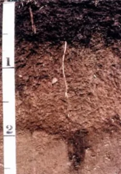
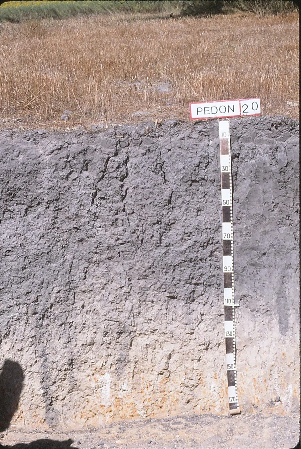
The soil types that dominate Vermont — how each drains decides more about crop success than almost anything else. Tap any soil to learn what it is and how to work with it. Each photo is a representative profile of that soil type; the named series is where it was documented, which is often another state.

Lester soil profile: brown unsorted glacial till
Representative Glacial tillSoil profile: Lester series, Minnesota

Glacial till

  • Drainage

    Variable by the shovelful. Sandy till drains freely; dense, compacted till (hardpan) can perch water above it after snowmelt and heavy rain.

  • What thrives

    Apples, stone fruits, brambles, and the whole northern vegetable garden do well on till — much of New England and the upper Midwest farms it. Deep-rooted perennials work through the stony structure happily.

How to work with Glacial till
Vertic Argiustoll pedon: dense gray vertic clay profile with a depth scale, Victoria County, Texas
Representative ClaySoil profile: Vertic Argiustoll, Victoria County, TexasPhoto: Soil Science (soilscience.info, NC State), CC BY 2.0 · CC BY 2.0

Clay

  • Drainage

    Slow. Water enters clay reluctantly and leaves it the same way, so wet springs keep it cold and unworkable longer than lighter soils.

  • What thrives

    Once established, heavy feeders prosper — brassicas, beans, corn, and many fruit trees ride clay’s nutrient supply and summer moisture reserve. Daylilies, roses, and prairie perennials handle it without complaint.

How to work with Clay
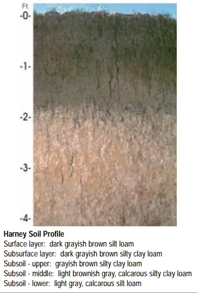
Harney soil profile: deep loessal silt loam with a dark grayish-brown surface
Representative Silt loamSoil profile: Harney series, Kansas

Silt loam

  • Drainage

    Moderate. Silt holds water well and releases it steadily, though the fine particles can crust after hard rain and compact under traffic.

  • What thrives

    The full vegetable garden does well here, and small grains, corn, and leafy greens are classic silt-loam crops. Its steady moisture suits shallow-rooted plants that dislike drought stress.

How to work with Silt loam

Loam threaded with stones — the signature of ground where glaciers, mountains, or shallow bedrock keep feeding rock into the topsoil. Every New England stone wall started as a rocky-loam garden bed.

Rocky loam

  • Drainage

    Good. The stones keep channels open through the profile, and rocky ground rarely waterlogs.

  • What thrives

    Fruit trees, brambles, asparagus, herbs, and deep-rooted perennials thread between the stones happily. Root crops that need clean, straight runs — long carrots, parsnips — prefer a picked-over or raised bed.

How to work with Rocky loam

Soil data: USDA NRCS SSURGO · Soil types explained

Is it too late to plant in Vermont?

Rarely: the season closes in stages, not all at once, and each stage has its crops. Across Vermont, cool-season planting typically opens about four weeks before the local last hard freeze — county medians put that freeze near May 3, with the middle half of counties between Apr 27 and May 5 (NOAA 1991–2020 climate normals). Tender transplants wait two to three weeks past it, and fall planting counts back from first freezes mostly between Oct 10 and Oct 17 — long-season crops need about 90 days of runway, quick greens only 30. Even past midsummer there is room for a true fall garden here, and garlic planted near the close carries the momentum into next year.

State Symbols of Vermont

The plants Vermont put its name on — cultural emblems, not growing recommendations.

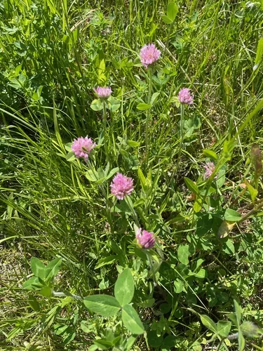
Red clover, photograph
Official state flower

Red clover

Trifolium pratense

Designated 1894. In our plant library — see its full growing profile.

Sugar maple, photograph
Official state tree

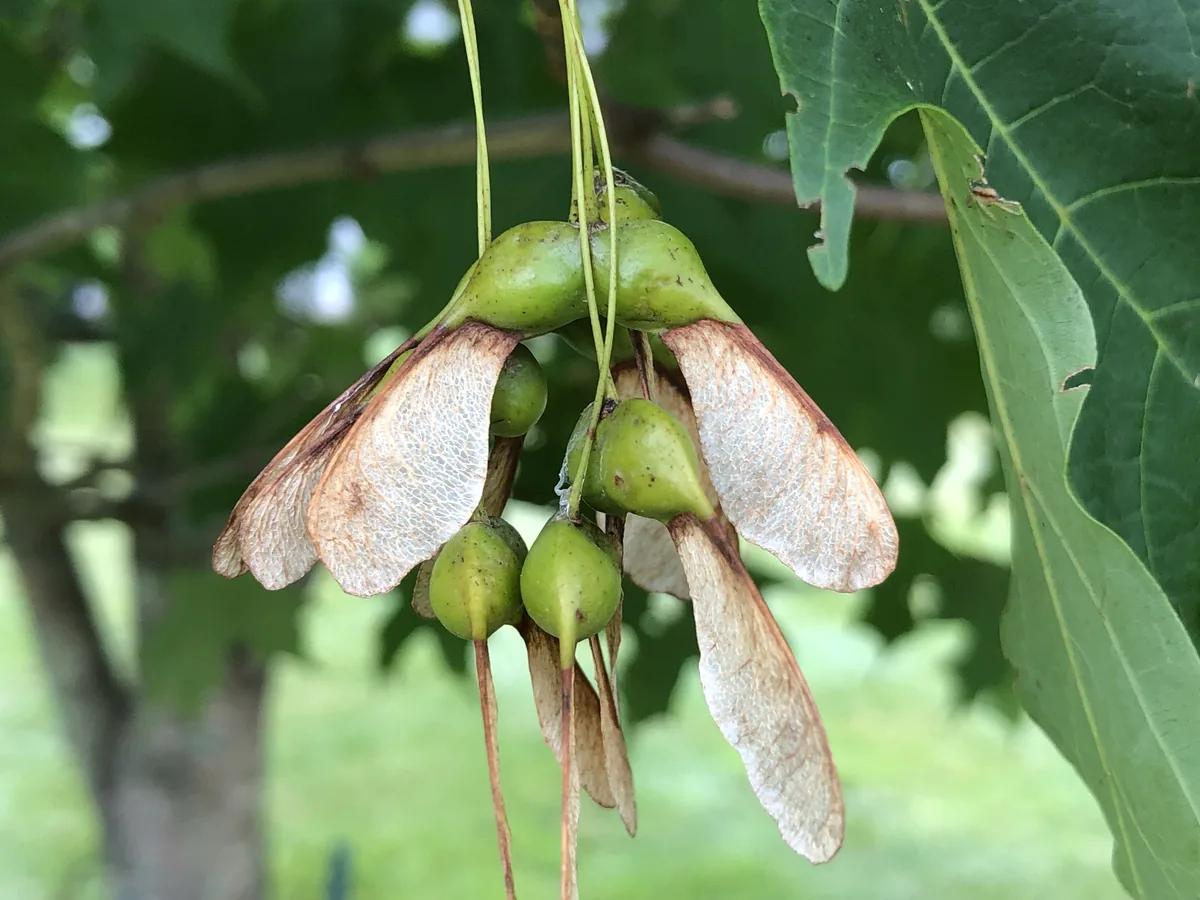
Sugar maple

Acer saccharum

Designated 1949. In our plant library — see its full growing profile.

Apple, photograph
Official state fruit

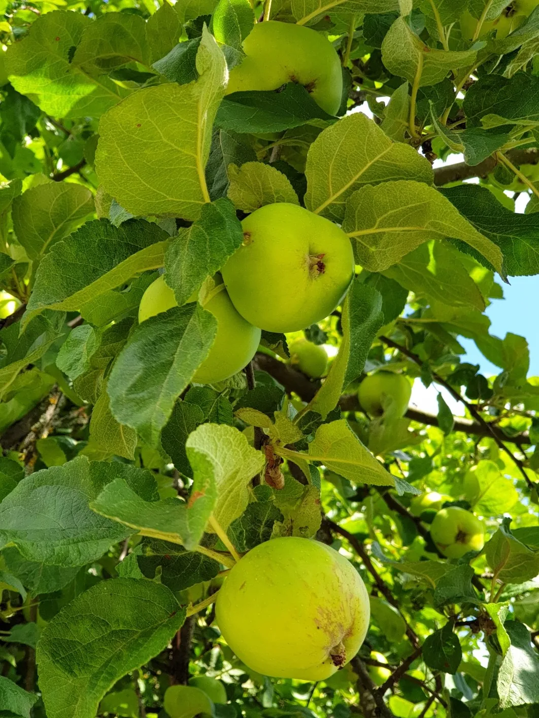
Apple

Designated 1999. In our plant library — see its full growing profile.

Official state vegetable

Gilfeather Turnip

Designated 2015.

Native Plants of Vermont

Plants the USDA PLANTS Database documents as native and present in Vermont — a real per-state range, not just a zone match. Ordered by how closely each plant’s published hardiness range matches Vermont’s zones 4a-6a, so this is a shortlist by climate fit, not a ranking of which plants matter most here. Presence is statewide, so a plant may still be uncommon in your specific county; your state’s Cooperative Extension or a native-plant society is the local authority.

Also zone-compatible

US-native plants whose hardiness range overlaps Vermont’s USDA zones 4a-6a but which USDA PLANTS doesn’t map to a single state range here. Zone overlap is a starting filter, not a range map.

Browse all US-native plants by state & zone →

Growing Challenges in Vermont

What an experienced grower plans around here — each one has a move.

Short growing season (100-130 frost-free days)

Indoor starts, fast varieties, and a cold frame on each shoulder — the Vermont formula for making 110 days feel like 150.

Rocky soils throughout the Green Mountains

Raised beds spare you the stone harvest — build up over cleared ground and plant the same weekend.

Heavy clay in the Champlain Valley

Champlain clay holds spring water late — raised or mounded beds dry out and warm up weeks earlier for planting.

For cultivar selection, pest pressure, and planting-time guidance specific to Vermont, the UVM Extension is the authoritative local source.

Safe to Grow Here?

What the federal record shows across Vermont — and how to grow with it.

Federal record: High

We checked the federal record across Vermont6,987 documented sites across 8 of the 9 source types we track.

The most significant on record: 41 Superfund sites. Sites tracked in EPA's Superfund program — from assessment-stage CERCLIS entries to confirmed National Priorities List cleanup sites.

Vermont carries one of the heavier federal records we track — and that's not a verdict on your yard. Proximity to a documented site is information, not a diagnosis: nothing here says any particular parcel is affected. It does earn one concrete step — before food beds go in the ground, a professional soil test tells you exactly what you're working with, and raised beds with clean imported soil grow well almost anywhere in the meantime.

Severity Distribution

across Vermont

High36Moderate1,365Low5,586

Highest-Severity Sites

Arsenic Mine (1924)
Mining Sites · Past Producer
Bennington Municipal Sanitary Landfill
Superfund · Superfund NPL
Berlin Health Rehabilitation Ctr
PFAS Sampling · PFAS Detected
Bfi Sanitary Landfill (Rockingham)
Superfund · Superfund NPL
Burgess Brothers Landfill
Superfund · Superfund NPL

Know Before You Grow

  • Underground tanks leak petroleum as they age — near a former filling station, test the soil.
  • Near a brownfield, raised beds of imported soil give your food clean ground.
  • On a private well, test for nitrates: above 10 mg/L the water needs treatment before irrigating.

Sources: EPA, USGS1.8M documented sites tracked nationwide across 9 federal source types.

Your land is one point inside Vermont

Everything above resolves to Vermont as a whole — a state whose own counties record seasons 44 days apart, and hardiness across zones 4a-6a. Your parcel sits at one point in that range, not in the middle of it. Slope, tree cover, a low spot that pools cold air, and what is in the soil are all resolved at the address, and none of them are visible at state scale. That is the honest boundary of this page, and the reason the next step is a reading of your own ground rather than a better statewide average.

See what grows on YOUR specific land

State averages sketch the shape. Your soil, sun exposure, drainage, and microclimate decide what actually takes. Pull a site-specific report for your exact parcel.

Free Report

Read your Vermont parcel

Enter your address. We read your soil, sun, drainage, and frost dates, then score 1,086 plants against the real conditions on your land.

Three things about your lot that Vermont averages can't show:

Your soil pHYour frost-free days — Vermont averages 163Your sun & shade

We read public map data around Vermont — soil, climate, flood, and parcel records. How we handle your address.

25+ data sources read at your address, not the Vermont average

How we know this about Vermont

The datasets: hardiness from the USDA ARS Plant Hardiness Zone Map 2023, read per county and aggregated to the state band; the growing season from NOAA Regional Climate Centers ACIS 1991–2020 28°F normals, read at each county’s own record; rainfall from NOAA Climate Normals; soils from USDA NRCS SSURGO; boundaries from US Census TIGER/Line 2025; the contamination record from the federal sources named in that beat above. Where a county carries no record of its own, it is absent from the figure rather than filled in.

Common questions about Vermont

What USDA hardiness zones are in Vermont?

Vermont spans USDA hardiness zones 4a-6a — which is to say winter's coldest night runs from about −30°F to −5°F depending where in Vermont you are, averaged over 1991–2020 (USDA PHZM 2023).

Is it too late to plant in Vermont?

Rarely: the season closes in stages, not all at once, and each stage has its crops. Across Vermont, cool-season planting typically opens about four weeks before the local last hard freeze — county medians put that freeze near May 3, with the middle half of counties between Apr 27 and May 5 (NOAA 1991–2020 climate normals). Tender transplants wait two to three weeks past it, and fall planting counts back from first freezes mostly between Oct 10 and Oct 17 — long-season crops need about 90 days of runway, quick greens only 30. Even past midsummer there is room for a true fall garden here, and garlic planted near the close carries the momentum into next year.

When does frost risk typically end in Vermont?

Across Vermont, the middle half of counties see their last hard freeze (28°F) between about Apr 27 and May 5, with a county median near May 3 (NOAA 1991–2020 climate normals). That marks the hard freeze, not the last light frost — lighter frosts keep biting past it, which is why tender transplants here wait until about May 24.

How long is the growing season in Vermont?

Measured between 28°F hard freezes, growing seasons across Vermont's counties mostly run about 158 to 173 days, with a county median near 163 (NOAA 1991–2020 climate normals). Tender crops get a somewhat shorter practical window, since lighter frosts reach a few weeks past the hard-freeze dates on both ends.

What vegetables grow well in Vermont?

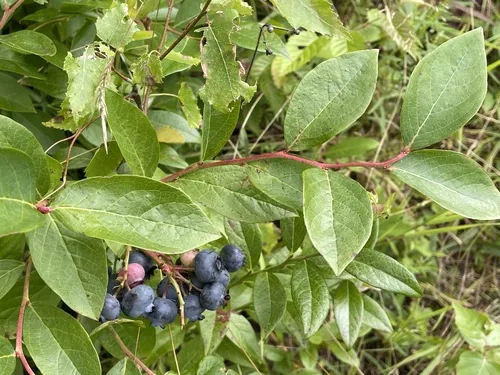
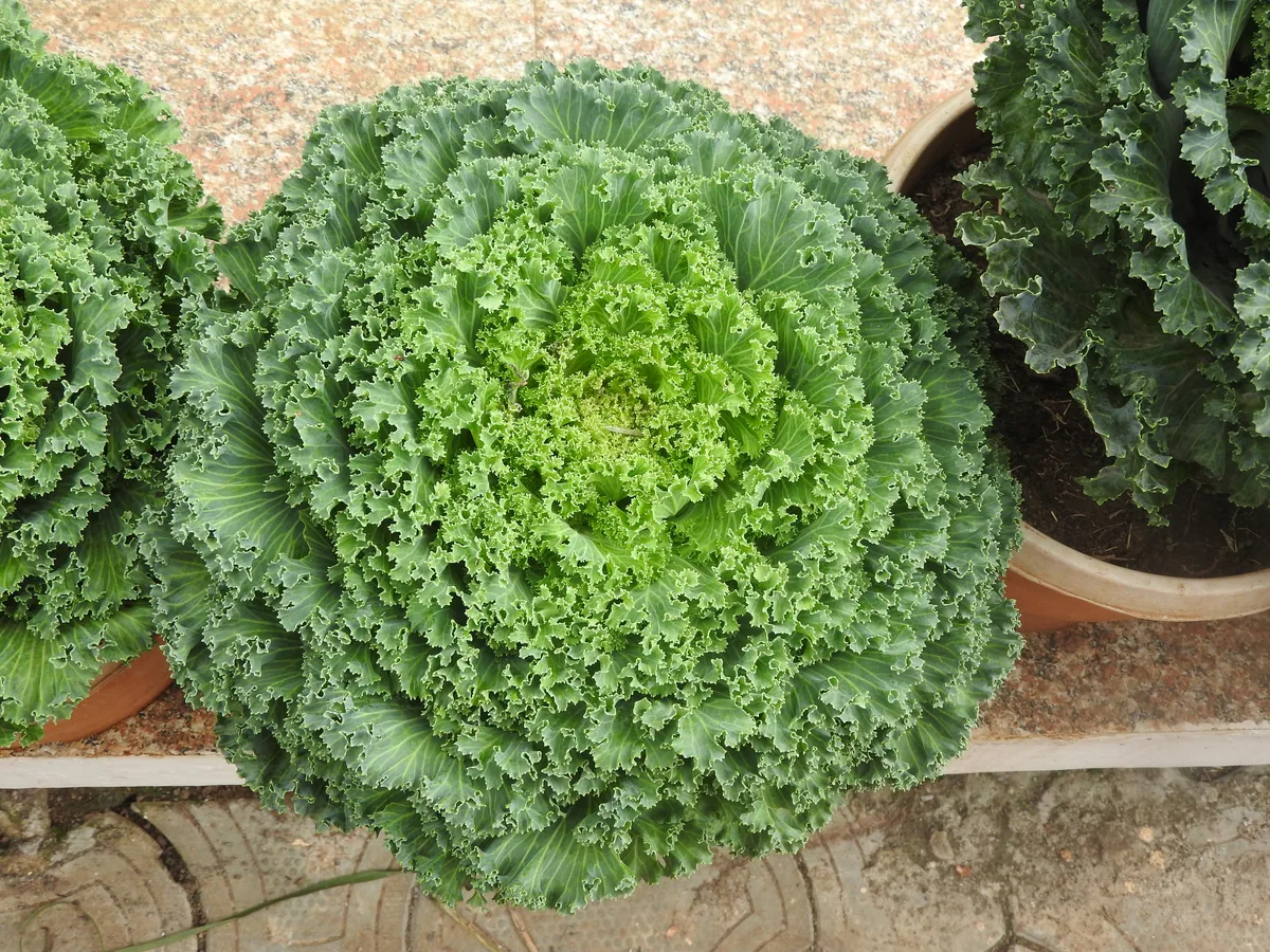
Vermont's zones 4a-6a support a wide range — strong performers include Sugar Maple, Apple, Garlic, Blueberry, and Kale. What actually takes on any one site comes down to its soil, sun, and drainage, and we score each plant against the real conditions at your address.

Which hardiness zone is Vermont, really?

Officially, Vermont spans USDA zones 4a-6a (USDA PHZM 2023) — but a zone is a 30-year average of winter's coldest night across an area, and it can't see any one yard. A south-facing slope, a tree line, or a low frost pocket can shift a single site by half a zone either way, which is why neighboring gardeners often quote different numbers. We read the conditions at your exact address — soil, sun, slope, and frost — and score 1,086 plants against what's actually there.

Is the soil safe to grow vegetables in Vermont?

The federal record across Vermont runs heavier than most — 6,987 documented sites, mostly Underground Storage Tanks entries (3,521) — so test the soil before planting food in the ground, and raised beds with clean imported soil grow well in the meantime. Even here, proximity to a documented site is information, not a diagnosis of any one yard; the contamination map shows exactly what's recorded and where.

Just moved to Vermont — what should I know before planting?

Start with three facts. Vermont spans USDA zones 4a-6a, which sets what survives winter; last hard freezes range from about Apr 27 to May 5 across its counties (NOAA 1991–2020 climate normals); and 6,987 documented sites sit on the federal record here, so a soil test before food beds is the smart first step. From there, matching plants to your actual soil and sun is the fun part.


Everything above is measured at Vermont's scale — its 4a-6a band and its 163-day season. Your yard writes its own version of Vermont's numbers: we read soil, sun, drainage and frost at your exact address. Try it for 14 days — no card required.

What this page reads at Vermont’s own scale

6 of the readings below were taken at Vermont's own scale — the full zone 4a-6a span inside its borders, the 4 soil types that dominate its ground and 6,987 documented sites on its federal record; anything it cannot resolve at this scale is named below.

Measured here

  • The full span of USDA hardiness zones 4a-6a inside Vermont's bordersUSDA PHZM 2023
  • A statewide 28°F hard-freeze window — the middle half of counties run roughly Apr 27 - May 5 to Oct 10 - Oct 17NOAA Regional Climate Centers ACIS, 1991-2020
  • 34-44 inches of annual rainfall across the stateNOAA Climate Normals
  • A statewide median of about 1,746 growing-degree days and about 2,500 winter chill hours, aggregated county by countyPRISM 1991–2020 normals
  • The 4 soil types that dominate Vermont's groundUSDA NRCS SSURGO
  • 6,987 documented contamination sites on the state's federal recordFederal environmental registers

What this page can’t tell you

  • Which single zone your own corner of Vermont sits in — zones 4a-6a is the full span across all 14 counties, not a reading anywhere in particularcounty guides
  • When YOUR last frost actually lands — each of the 14 counties below carries its own normal, days to weeks off the statewide windowfrost dates explained
  • The soil pH, drainage, sun hours, and frost pockets on one specific lotwhy one lot differs from the next
Narrow it down: 14 counties in Vermont

Counties in Vermont

Explore growing conditions by county — each has its own zone range and land area.

Cities & Towns in Vermont

Explore growing conditions by city or town in Vermont.

AlbanyAlburghAlgiersArlingtonAscutneyBakersfieldBarnetBarreBartonBeecher FallsBellows FallsBenningtonBensonBethelBolton ValleyBradfordBrandonBrattleboroBristolBurlingtonCabotCambridgeCanaanCastletonCastleton Four CornersCavendishChelseaChesterChimney HillChittendenConcordCoventryDanbyDanvilleDerby CenterDerby LineDorsetEast BarreEast BurkeEast CharlotteEast DorsetEast MiddleburyEast MontpelierEast PoultneyEnosburg FallsEssex JunctionFair HavenFairfaxFairleeGilmanGloverGraftonGranitevilleGreensboroGreensboro BendGrotonHanksvilleHardwickHarmonyvilleHartford VillageHartlandHighgate CenterHighgate SpringsHinesburgHuntingtonHuntington CenterHyde ParkIrasburgIsland PondJacksonvilleJamaicaJeffersonvilleJerichoJericho CenterJohnsonKillington VillageLincolnLondonderryLowellLudlowLunenburgLyndonLyndon CenterLyndonvilleManchesterManchester CenterMarshfieldMiddleburyMiddletown SpringsMiltonMontpelierMorrisvilleNew HavenNewburyNewfaneNewportNewport CenterNorth BenningtonNorth ClarendonNorth HartlandNorth Hyde ParkNorth PownalNorth SpringfieldNorth TroyNorth WestminsterNorthfieldNorwichOld BenningtonOrleansPawletPeachamPittsfordPlainfieldPoultneyPownalPownal CenterProctorProctorsvillePutneyQuecheeRandolphReadsboroRichfordRichmondRochesterRutlandSaxtons RiverSheffieldShelburneSouth BarreSouth BurlingtonSouth HeroSouth LincolnSouth LondonderrySouth RoyaltonSouth ShaftsburySouth WoodstockSpringfieldSt. AlbansSt. GeorgeSt. JohnsburyStamfordStoweStratton MountainSuttonSwantonTownshendTroyUnderhill CenterUnderhill FlatsVergennesWaitsfieldWallingfordWardsboroWaterburyWaterbury CenterWebstervilleWellsWells RiverWest BrattleboroWest BurkeWest CharlotteWest DummerstonWest PawletWest RutlandWest WoodstockWestfordWestminsterWestonWhite River JunctionWhitinghamWilderWilliamstownWilmingtonWindsorWinooskiWolcottWoodstockWorcester

States with a Similar Growing Climate

Vermont shares its dominant growing region with these states — a useful comparison if you're weighing where a crop will behave the same way.